
Fera Science Conveys Scientific Evidence to Decision Makers
/
The agri-food research company Fera Science, renowned for original thinking that can be applied in the field, has developed a GIS-based web app to help its clients respond to the challenges of population growth, pollution and climate change. The app presents high resolution imagery from an Unmanned Aerial System, enabling decision makers to more easily identify ways to protect natural resources and food security.
Fera Science delivers research projects and scientific data to more than 7,500 government and commercial organisations in the agriculture and environment industries in the UK. After investing in an Unmanned Aerial System (UAS) to capture high resolution spatial imagery, the organisation built a customisable web app, using Esri’s ArcGIS platform, to make the imagery and analysis available to its clients in a format that they could interrogate, interpret and ultimately use to make better-informed decisions.
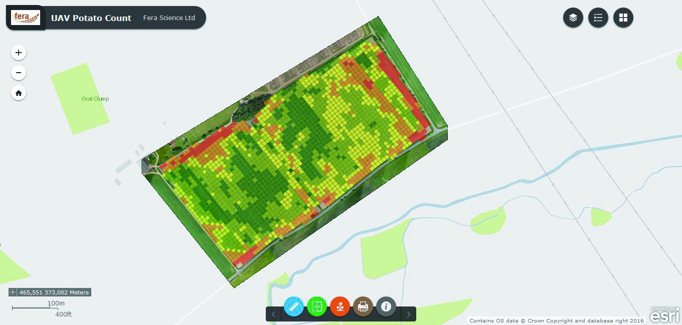
The web app has already been successfully employed by a large food producer to identify opportunities to increase crop production. The company, which grows potatoes and root vegetables, used the web app to analyse aerial imagery of its crops and identify unexpected gaps in fields, where the agricultural machinery had not planted in a uniform manner. Enlightened, the company is now using its newly-gained insight to review its planting techniques and increase crop yields for next year.
“By creating custom ArcGIS web apps, we empower our customers to make the best decisions to protect the environment, improve agricultural yield and manage land sustainably.”
Another of Fera’s clients, a government agency, is using the web app to help monitor the outbreak of disease in trees more cost efficiently and effectively, to protect British woodlands. Tree inspectors view imagery collected via the UAS and use the web app to pinpoint the precise locations of tree species that are susceptible to particularly virulent pests and diseases. With this more accurate information, they can focus their efforts on the right locations and react more quickly to prevent the destruction of precious natural environments.
For more information on our web apps, visit esriuk.com/software/apps.