The latest update to ArcGIS Pro, Esri’s flagship desktop application, has now arrived. This update brings a huge amount of new features and advances to your desktop, and we don’t want you to miss out. Let me put a spring in your step, and guide you through a selection of what’s new in ArcGIS Pro 2.2.
Alterations to the Map Interface
There are lots of new features to help you get the most from your maps, like being able to Show Map Tip for a layer (in the Display properties), here are a few.
You can now input coordinate locations straight in to your map, and navigate using the Go To XY tool. The movable display allows you to input coordinates by typing directly or pasting from another source. A history of the last five coordinates entered in the current session is maintained:
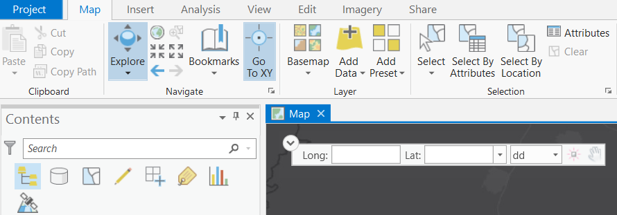
To copy the current location to the clipboard, right-click the location and Copy Coordinates . You can convert the current coordinates to a different unit format by clicking Convert Coordinates and choosing your desired output.
Further developments to the interface include an improved user experience for Pop-ups. You can click a feature using the Explore tool or drag a box (with Ctrl held down) to identify multiple features. The Pop-up pane displays a list of identified features, grouped by layer, and a formatted list of field attributes. You can now pin a pop-up to the screen (right-click on the item in the Pop-up pane) to compare multiple pop-ups!
When you run ArcGIS Pro without signing into your organisation, the maps in your basemap gallery will be vector basemaps only. New maps and scenes will be created with these vector basemaps.
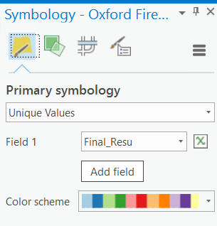
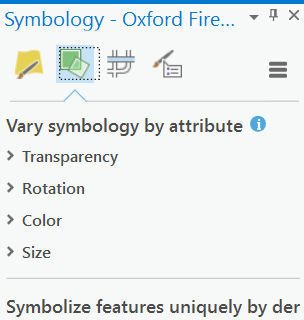
Changes to Symbology
The Symbology pane has also been reorganised with the following new tabs for ease of use:
- Primary symbology tab – set the main aspects of the symbology.
- Vary symbology by attribute tab – set up multivariate symbology by symbolising on additional fields.
- Symbol layer drawing tab – manage the way symbol elements are layered in the draw order across features.
- Advanced symbol options tab – access symbol settings such as masking and classification sample sizes.
There are three new colour schemes in the ArcGIS Colours System Style – Inferno, Magma and Viridis. These schemes present values with increasing lightness, leading to a more accurate portrayal of data. This is particularly useful with imagery, unclassed and graduated colours symbology, and LAS symbology.
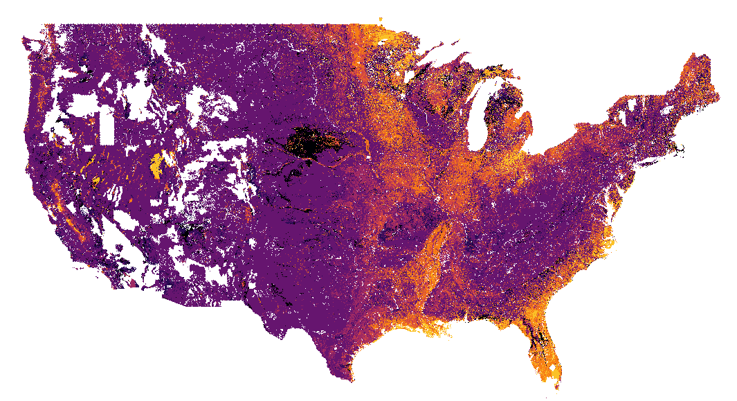 USA soils drainage class – inferno
You can also download a PDF document that shows every symbol and item included in the ArcGIS Pro system styles!
Dot density symbology has also been updated with a number of additional capabilities.
Revit Support
GIS has a key role to play within the BIM process, providing geographic context to the information held in detailed 3D models of buildings and infrastructure. Last November Esri and Autodesk announced a strategic partnership and one of the first products of this has arrived: Autodesk Revit files (RVT) can now be read directly in ArcGIS Pro. For Revit models this avoids having to convert the data via Industry Foundation Class (IFC) files with the Data Interoperability Extension.
With this new capability, GIS users will be able to visualise BIM information in ArcGIS Pro, allowing the model to be visualised in a geographic context.
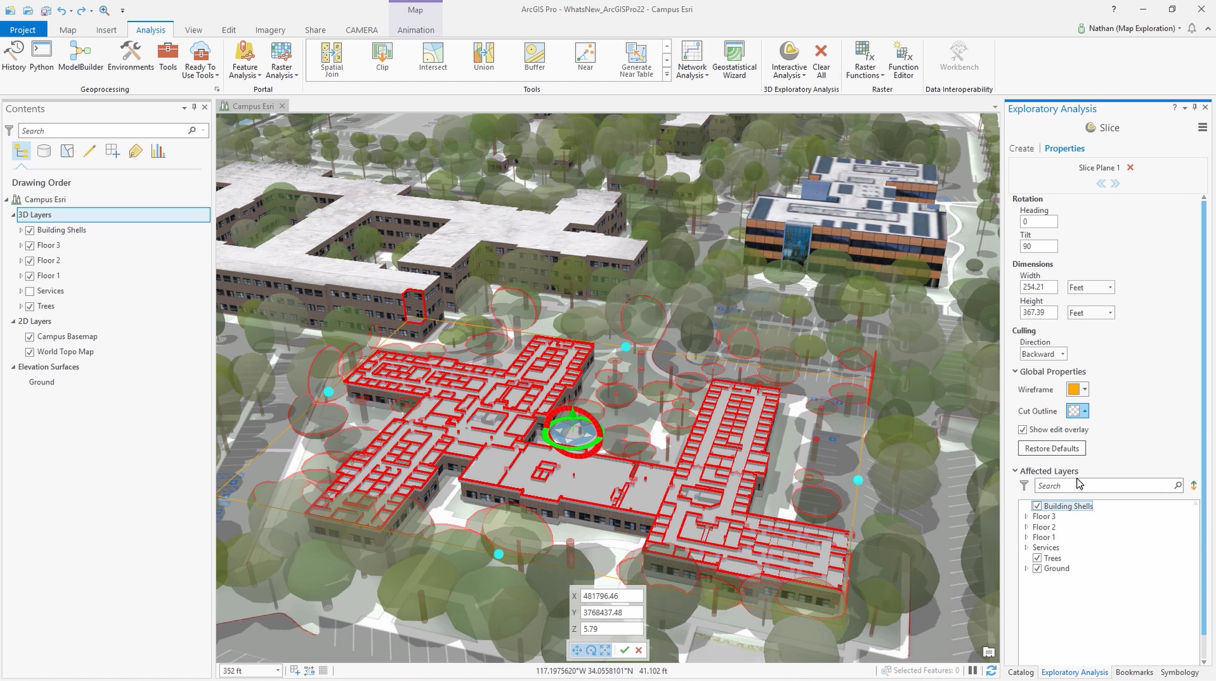
3D Slice Tool
The slice tool is a new Exploratory Analysis tool that lets you interactively slice through content in a 3D view to reveal hidden features. This is very useful when exploring building interiors and geological data.
Geoprocessing Updates
ArcGIS Pro 2.2 adds 50 new geoprocessing tools to your toolboxes (subject to licensing). These include:
- Calculate Geometry Attribute tool.
- Cartography tools for shared-edge generalisation.
- Conversion tools for converting to and from transit feeds.
- Spatial Statistics tools to perform Time Series Clustering and Forest-based Classification and Regression.
- Territory Design tools
- Imagery Analyst tools that use machine learning to classify images and detect objects.
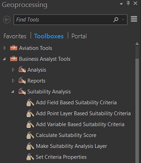
- Suitability analysis tools in the Business Analyst toolbox (opposite).
Batch geoprocessing has been added, so you can automate running a tool multiple times using using different inputs or parameter settings.
Full Motion Video
There will now be support for Full Motion Video (FMV) as part of the Imagery Analyst Extension. This will give ArcGIS Pro users the ability to quickly and easily visualise video data captured from aerial drones, manned aircraft or other platforms. Pro 2.2. will let you add points of interest to the video and have them automatically georeferenced in the map. You can then easily save this data as a feature class to be accessed any time. This is just one example of the new FMV capabilities.
And so much more…
ArcGIS Pro 2.2 has so much to offer in this update; from subtle enhancements to brand new functions and tool sets. This blog is only a small snapshot of what has arrived. You can learn more in the What’s new in ArcGIS Pro 2.2 guide.
![]()