Ever wondered how you can create new territories from an existing set of boundaries? This is a common problem faced by many people when trying to re-organise their sales force into well-defined territories. There is no easy way to quickly create well balanced territories based on a set of boundaries with specific attributes. Fret no more, because Districting is here!
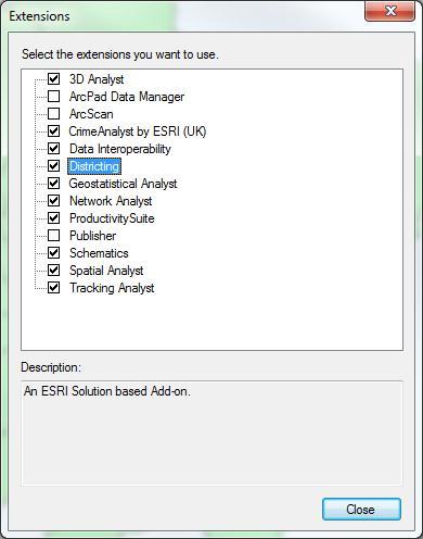
Districting for 10.1 is an ArcGIS add-in which was available at previous versions as well. The add-in essentially allows you to interactively create new territories based on an existing geography (boundary) and any specified attribute. You can download the add-in here. Once you have installed the add-in, enable it by going to Customise –> Extensions and checking the box next to districting:
This will turn on the Districting tool-bar:

Using the districting toolbar, we can interactively create new ‘plans’ based on existing geographies to suit our needs. As you create new districts, you get feedback through the chart and summary table to guide your decision making process.
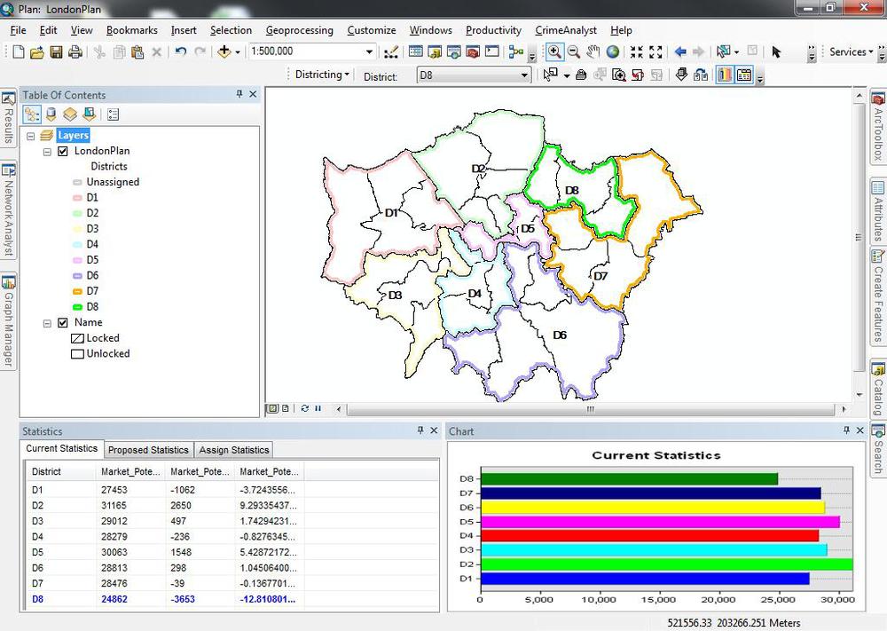
Once you have a satisfactory plan, you can export it as a map or export the data as a feature class that you can use in other GIS analysis.
The districting for ArcGIS Help document takes you through a detailed tutorial on utilizing the different features that this add-in has to offer. To finish off, I will leave you with an interesting game based on the districting concept – http://www.redistrictinggame.org/. Have fun!